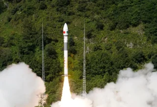
A Kuaizhou-1A (KZ-1A) carrier rocket carrying the Pakistan Remote-Sensing Satellite (PRSS-1) blasts off from the Xichang Satellite Launch Center in southwest China’s Sichuan Province, July 31, 2025. Launched at 10:00 a.m. (Beijing Time) by a KZ-1A carrier rocket, the PRSS-1 has entered its planned orbit. The satellite will be primarily used in the fields of land resource surveys and disaster prevention and mitigation. (Photo by Wang Yinjie/Xinhua)
XICHANG: China on Thursday launched the Pakistan Remote-Sensing Satellite (PRSS-1) from the Xichang Satellite Launch Center in southwest China’s Sichuan Province.
Launched at 10:00 a.m. (Beijing Time) by a Kuaizhou-1A (KZ-1A) carrier rocket, the PRSS-1 has entered its planned orbit.
The satellite will be primarily used in the fields of land resource surveys and disaster prevention and mitigation.

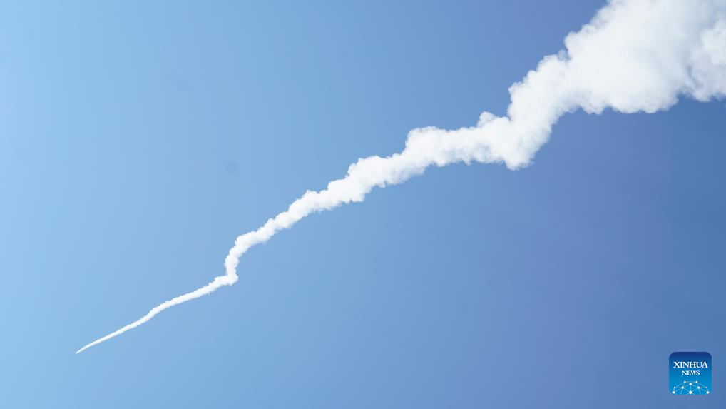
A Kuaizhou-1A (KZ-1A) carrier rocket carrying the Pakistan Remote-Sensing Satellite (PRSS-1) blasts off from the Xichang Satellite Launch Center in southwest China’s Sichuan Province, July 31, 2025. Launched at 10:00 a.m. (Beijing Time) by a KZ-1A carrier rocket, the PRSS-1 has entered its planned orbit.
The satellite will be primarily used in the fields of land resource surveys and disaster prevention and mitigation. (Photo by Wang Yinjie/Xinhua)